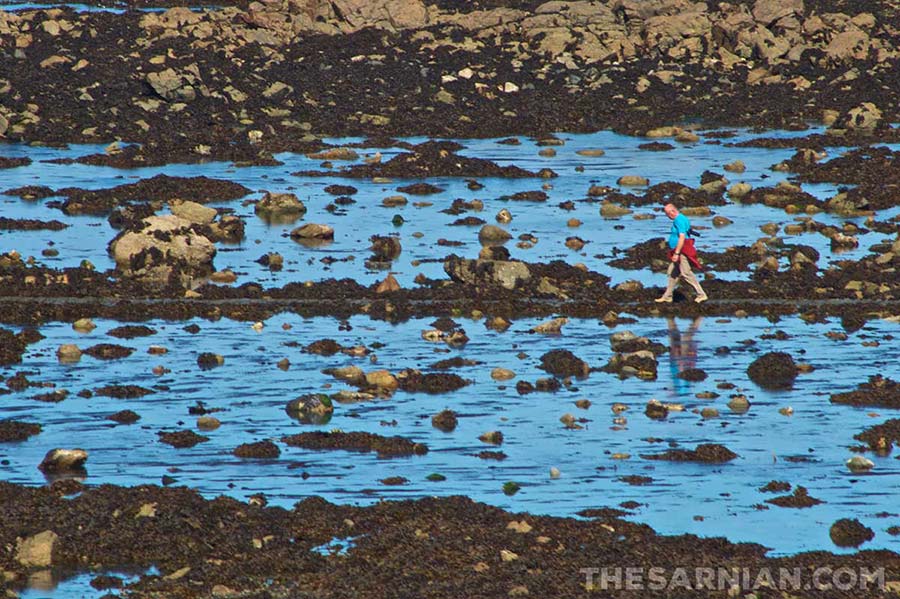
Havelet Bay
Havelet Bay sits close to St Peter Port and is centred on the bathing pools at La Vallette.
The area close to it is better known to those who fish as Cowhorn, and thus takes its name from the headland known as Cow’s Horn, upon which Clarence Battery was built. Remus Carey refers to it using this name when he is testing whether Marc Renouf has any knowledge of boats and boating around the island in book 1, Dead in the Water.

It features at the end of Toilers of the Sea by Victor Hugo, where he describes it thus:
This little harbour (which is the signification of the word) was near the town, but was so solitary that it seemed far off. This solitude was owing to the shelter of the high cliffs of Fort St. George, which overlooked this retired inlet.
The Havelet was accessible by several paths. The most direct was along the water’s side. It had the advantage of leading to the town and to the church in five minutes’ walk, and the disadvantage of being covered by the sea twice a day. The other paths were more or less abrupt, and led down to the creek through gaps in the steep rocks.
Even in broad daylight, it was dusk in the Havelet. Huge blocks overhanging it on all sides, and thick bushes and brambles cast a sort of soft twilight upon the rocks and waves below. Nothing could be more peaceful than this spot in calm weather; nothing more tumultuous during heavy seas. There were ends of branches there which were always wet with the foam.
In the spring time, the place was full of flowers, of nests, of perfumes, of birds, of butterflies, and bees. Thanks to recent improvements, this wild nook no longer exists. Fine, straight lines have taken the place of these wild features; masonry, quays, and little gardens, have made their appearance; earthwork has been the rage, and taste has finally subdued the eccentricities of the cliff, and the irregularities of the rocks below.
La Vallette bathing pools
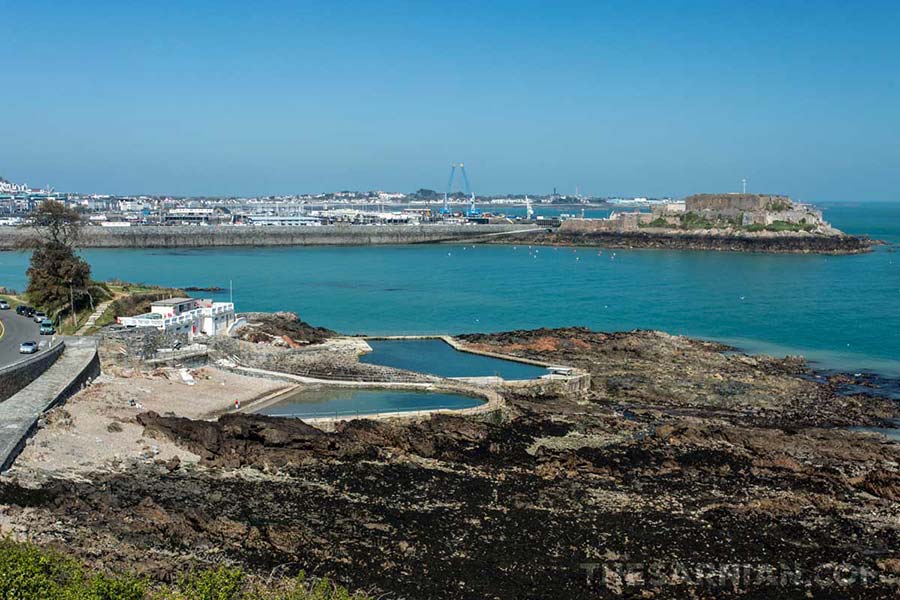
The bathing pools at La Vallette, close to Havelet Bay were built in 1844 to compensate for the loss of beaches caused by the expansion of St Peter Port harbour. It took almost 100 years for permanent changing rooms were installed, which finally arrived in the 1930s.
Originally the three pools were for men, women and children separately, although now they are known as the children’s, gents’ and horseshoe pools.
There is no chlorine in the pools as they are filled by the sea at high tide. As a result, there are also stones and sometimes seaweed in them and they are occasionally damaged in fierce storms.
They arguably have one of the best swimming views in the world, with the hill of Clarence Battery to one side and Castle Cornet and the Castle Breakwater the other.

Although it would be convenient for his work at The Sarnian, Oliver Carey chooses not to swim on the pools, preferring the secluded waters of the sea at Marble Bay. As explained in book 1, Dead in the Water,
He could have swum in Town, of course, up on the hill at Beau Sejour, or outside by the castle in the pools at La Vallette, but in both of those places he’d have to wear shorts, and his father had taught him to swim in the nude. It felt constricting to truss himself up in the water.
Elsewhere, Remus Carey takes Marc Renouf to Havelet Bay, close to the pools, on the Huffin’ Puffin, but refers to the area as Cowhorn, the fishermen’s name for the area.
The outdoor bathing pools are no longer as popular as they once were, as there is now an indoor pool at Beau Sejour.

The pools feature in the following 13 minute documentary by Guernsey-born Tim Bowditch.
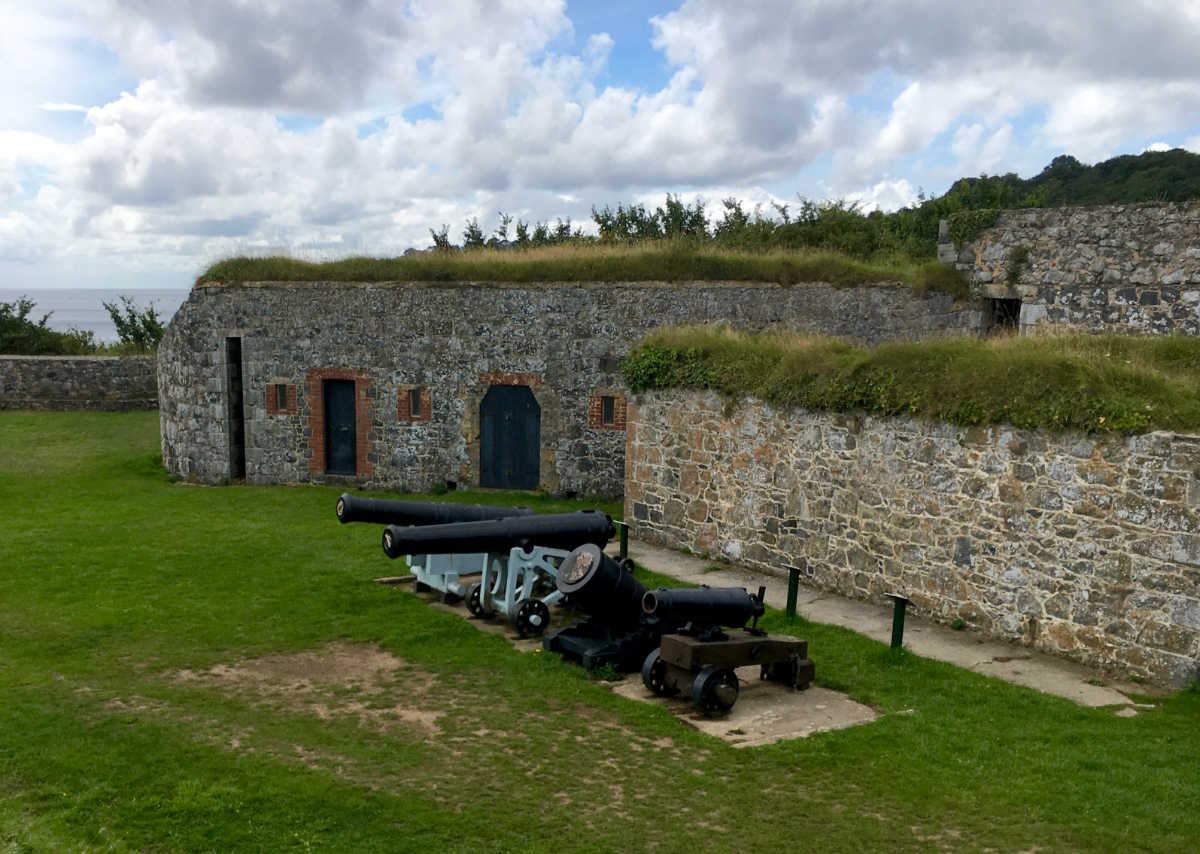
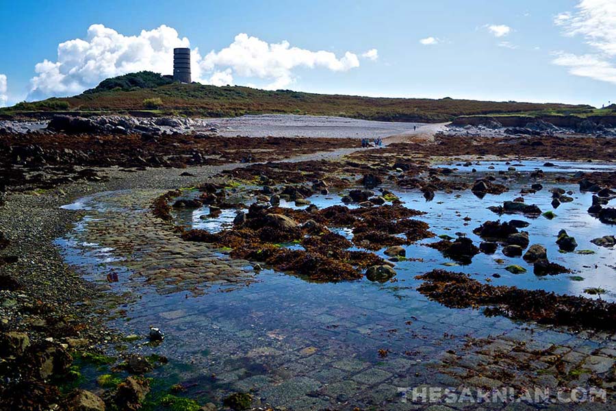
Clarence Battery
Clarence Battery was built in 1870 and was once part of a larger fortification that took in the area of Fort George. It is well preserved and consists of numerous armouries and thick walls, which would have give it protection when under attack. It was renamed in honour of George III’s son, Clarence, in 1815, having previously been called Terres Point Battery. (George himself gave his name to Fort George.)
Its position above the aquarium at La Villette gives it a commanding view across St Peter Port, Little Russell and Castle Cornet, along with the Castle Breakwater. The open air bathing pools at La Vallette are immediately below it, as can be seen from the picture below.

The position was an obvious spot for a defensive structure, so it’s no surprise that it was built when the French Revolution was at its height, and was used by the German occupying forces during the second world war as the site of the Luftwaffe’s early warning system.
Clarence Battery appears in book 2, Blowfish when Alton Hollett stands by the wall with his binoculars and looks down on the damage that a storm has caused to the Castle Breakwater.
He continued along the front, past all the signs of the town’s bombardment. The outdoor pools were filled with seaweed and rocks, and the road that led by them, up to the small aquarium, was strewn with detritus awaiting collection. The pavement was still submerged here and there, and he skipped out onto the road itself. He’d only brought one pair of shoes, which he couldn’t afford to get wet.
The map took him up to a set of stairs that led to a fort on a headland. He took them quickly, two at a time, and came out within the citadel’s walls, through which he could see right along the front. The building was incomplete, but better preserved than he’d thought it might be from the sign at the foot of the steps.
You will pass through Clarence Battery when walking south out of town on the coastal path that takes you as far as Jerbourg, via Fermain Bay, the Bluebell Woods and Marble Bay.
Bluebell woods

The woods between St Peter Port and Fermain Bay are carpeted with bluebells during the spring, making for some very spectacular walking opportunities. It is particularly interesting in that it’s very different to both the regular coastline, on which it lies, and the island’s interior.
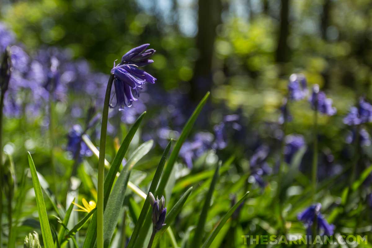
The woods are hilly, but are close to St Peter Port via Clarence Battery and Fort George. Many of the areas where the bluebells grow are fenced off so they aren’t trampled, but this doesn’t stop you seeing them.
Aside from the woods themselves, there are some great views across Little Russell to Herm where the path runs close enough to the coast itself to break out through the trees.

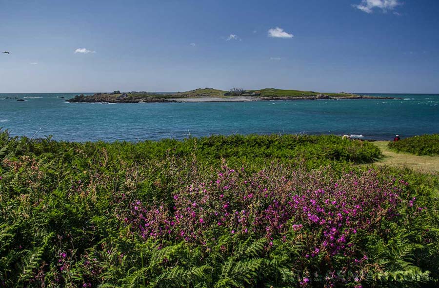
Lihou

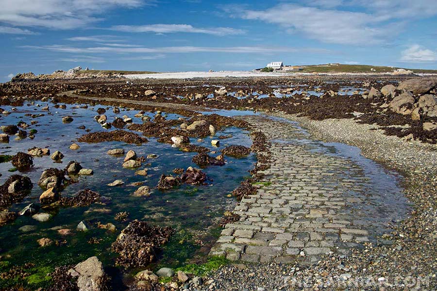
Lihou is a small island of the west coast of Guernsey. The two islands are linked by a causeway at low tide, which meets Guernsey at L’Eree headland. The island itself is 36 acres (15 hectares) and forms part of a wetland nature reserve that incorporates the causeway and some of the neighbouring area of Guernsey.
It is the most westerly point in the Channel Islands.
The States of Guernsey bought Lihou in January 1995 and it is now kept open for all to enjoy (subject to a safe crossing). There is just one useable building on the island, which is a house that can be booked out for parties or private accommodation. This is managed by the Lihou Island Charitable Trust, which actively encourages its use by younger people through a list of sliding prices.
The only other building on the island is the ruined remains of Lihou Priory (see image, below).
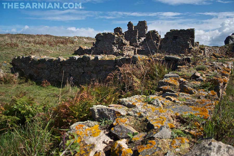
The Priory is believed to have been established by monks from Mont St Michel in Normandy in around 1114AD, and archaeological work done on the site has revealed graves and a covered walkway. Sadly it’s not possible for the untrained eye to make out any of this, although it is possible to walk inside the derelict structure.
The Priory was destroyed by the governor of Guernsey in 1759 to stop it falling into French hands during the Seven Years War. Further destruction came to the island when it was used for target practice by the German soldiers that had occupied the Channel Islands during the second world war. The farmhouse was destroyed in the process.

Lihou island featured in book 1, Dead in the Water, as the place where Marc Renouf and Ross Ferbrache were stranded while still at school.
Renouf has largely forgotten the event, but Ferbrache still hangs on to the memory:
He remembered the day they’d crossed to Lihou without first checking the tides. They were fourteen and twelve, and the rising water had flooded the causeway and stranded them both on the island. Then the rain had rolled in and they’d run to the ruins and taken shelter, just as the monks would have done, and they’d waited for the tide to turn. By the time they’d got back the coastguard was out on alert.

The duration of the causeway’s opening varies from day to day, and it can be passable for less than two hours or more than four. The States of Guernsey Environmental Services Unit publishes tide tables showing when it is safe to cross. However, even these can be 20 minutes different to reality depending on weather conditions. If you get stranded on the island and want to walk back you will need to wait until the following day or call emergency services.
There are no public toilets on the island.
It is hard to believe, today, that this largely barren island was once an important economic area for Guernsey, but from the beginning of the 19th century it was used for harvesting seaweed and, in 1927, a factory was established there to extract iodine from the weed itself.

Lihou has been designated an internationally ‘important bird area’, where many birds both nest and breed. Some areas are marked off to encourage the birds to take up residence on the island.
Aside from birds, Lihou is also home to a diverse range of sea life, as is obvious when you’re walking along the causeway and look down at the small crabs, limpets, winkles and other creatures that have been stranded. The waters around the island are also rich in Ormer.
Bailiwick
A bailiwick is a legal area administered by one body or person, known as the bailiff. In the case of the Channel Islands, there are two: the Bailiwick of Jersey, and the Bailiwick of Guernsey.
As well as covering Guernsey itself, the Bailiwick of Guernsey also takes in the neighbouring islands of Alderney, Sark, Herm, Brecqhou, Jethou, Crevichon and Lihou, plus the surrounding waters.
Bailiff of the Bailiwick of Guernsey
The bailiff is appointed by the Sovereign (king or queen) on the basis of recommendations made to them, although in practice, they will usually have served as the deputy bailiff before their appointment and are normally a qualified lawyer. Once appointed, they can continue serving until the point of retirement, which is usually 65.
The appointed bailiff oversees the Royal Court and will cast a deciding vote if the Jurats (judges) cannot agree on a judgement themselves, or make a solo decision if a case being heard is a matter of principle or preference, not being based on established facts. They are also the official link between the islands that they have been appointed to serve, and foreign government bodies (which includes the British government).
The Bailiff, Lieutenant Governor and Chief Minister
The bailiff works with the lieutenant governor, who is also appointed by the crown as the Sovereign’s official representative on the island. The lieutenant governor presides over States meetings.
Although the bailiff and lieutenant governor are appointed, the chief minister is elected, and is thus the most senior political position within the Bailiwick. Their official title is President of the Policy and Resources Committee. The Committee deals with Guernsey’s external affairs and day to day administration.
Fairy Ring
The Fairy Ring, known more traditionally as the Table Des Pions is a circular ditch cut into the grass close to Fort Pezeries in Pleinmont, Torteval. The centre of the ring is given over to a shallow grass hill. The edge is traced by large stones.
The ring has long been a point of local superstition. If you walk around it three times and make a wish, the wish is supposed to come true.

However, its broadly accepted historical use is as a meeting place for workers who would sit with their feet in the empty ditch, facing each other around the circle.
In the words of the BBC,
The Chevauchee was a parade that took place every two years to check the Chemain du Roi, or path of the King, was kept clear so dignitaries were free to travel around the island unobstructed. Starting at the Vale Church in the morning and ending back at Grand Harve one of the stopping points on the route was at Pezeries Point where a feast would be held for the officials of the Royal Court who made the procession.
While the officials would eat in the shelter of a specially constructed tent, the ‘Pions’ who accompanied them would not be permitted entrance to the tent and so the table was dug into the common to allow them somewhere to eat.
Beaucette Marina
Beaucette Marina was once a quarry, used to extract granite, which was one of the island’s main exports. However, by the second world war it had more or less been worked to its fullest extent, and when work on the site stopped the sea started to move in. By the late sixties it had flooded.
At that point, the owner took the decision to turn it into a proper marina by removing the wall of rock that stood between the quarry and the sea. He invited the army to take it down for him, as it would give them an opportunity to practice their explosives work. The Royal Engineers estimated that the work would take nine men three weeks to complete (source: Beaucette Marina), at a cost of £2,300.
This turned out to be a significant underestimate and it took several attempts to bring down the last standing wall of stone. In total, over 60 men worked on the job for seven months and the cost rose to more than £30,000.

Beaucette is the marina where Marie Budzinski keeps the Dalliance, which is the boat that she and Marc Renouf at different times throughout the Sarnian series.
It is also the place to which George Dixon heads after spending the night in his car in book 1, Dead in the Water, when he is looking for something to eat. Unfortunately, upon arriving, he finds that he is too early to buy food there.
Beaucette Marina is close to La Fontenelle, which is where Christine Le Page is staying with her husband, Dan, while she is seconded to work with the police force on Guernsey.
Torteval
Torteval is a parish in the west of Guernsey. It is split into two parts, with St Saviour and St Pierre du Bois splitting one part from the other. It runs along a lot of the south coast and takes over the whole of the south western toe of the island, encompassing Portelet, where Remus Carey’s boat the Huffin’ Puffin is moored, and Pleinmont, the headland that gives good views of the lighthouse at Les Hanois.

Oliver Carey often finds himself cycling through Torteval as it is on the road home from The Sarnian’s newsroom in St Peter Port.
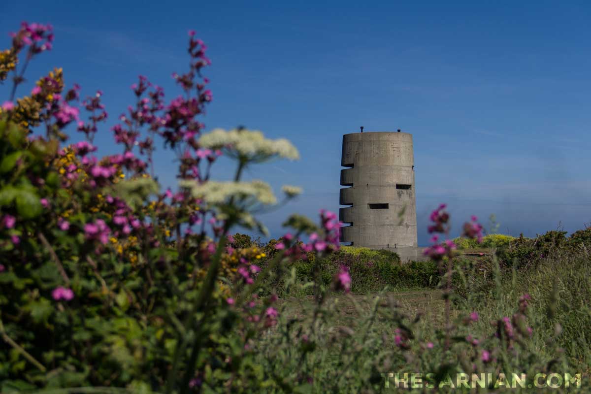
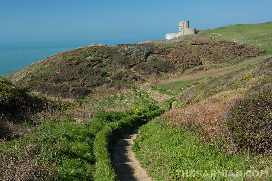
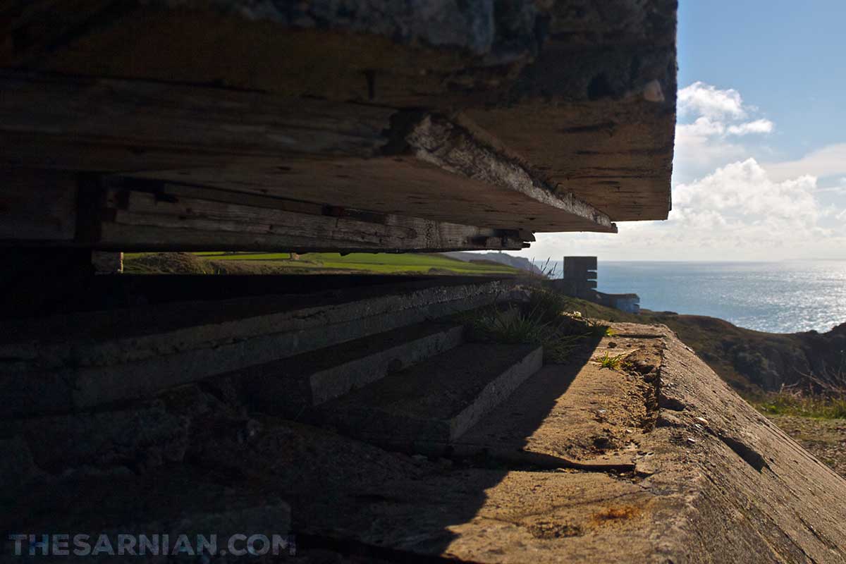
One of the largest bunkers in Torteval isn’t the round bunker (above) that’s sometimes open to the public, but the multi-level block that seems to tip down one of the headlands (see below). It has no door, so is open to the public, and although you’ll have to scramble over rubble on the floor through which you enter, it’s possible to climb to the upper and lower levels by way of the unguarded staircase.

Oliver Carey visited the bunker many times in his youth, and is surprised how much neater the circular tower at Pleinmont is in comparison. As outlined in book 2, Blowfish:
The tower [at Pleinmont] was plain from the outside: the kind of thing a child might build in the sand, as an almost perfect cylinder that narrowed slightly towards the top. The seaward side had been slashed five times as though it had suffered five blows from an axe, and each of the slashes had been glassed in since the war. Ollie was surprised how clean and ordered it was compared to the other towers he’d been in. He’d often entered the open towers further along the coast – got drunk in them as a teenager, lost his virginity in one of them the night before he turned twenty-two – but never been here, where the tower had been kept good for the tourists, with whitewashed walls sporting German motifs in threatening, stencilled black letters.
Fort Pezeries and the Fairy Ring also fall within the parish boundaries.
Torteval has a distinctive church with a circular tower and clear glass windows, which let in good light at the end of the day. It was built in 1818 and is said to have both the tallest steeple and oldest bells in the island.

The book Guernsey by GWS Robinson has the following to say of Torteval church:
The odd man out [in terms of grouping the island’s parish churches by architectural style] is Torteval. The medieval building was allowed to decay in the eighteenth century and was pulled down in 1818. The new church was characterised by a most unusual tower and spire entirely unlike anything else in the island; it is quite remarkably round and smooth, tall in proportion, not at all attractive and uneasy in its setting, though none the less memorable.
Robinson is at odds with Thomas Bellamy’s Guernsey Pictorial Directory and Stranger’s Guide, which dates the destruction of the old church to 1818, and describes it as having had:
a nave, chancel, South aisle, porch, and low, square tower, pinnacled and surmounted by an octagonal spire at the West end of the nave. It was built by Sir Phillip De Carteret, in the year 1140, in consequence of a vow made at sea. Sir Phillip was the son of Sir William De Carteret, co-Lord with the King of France of the barony of Carteret in Normandy.
The name Torteval comes from the Guernesiais word for twisting valley.

The highest parts of the parish are a nature reserve, which was renewed for the Queen’s Diamond Jubilee in 2012. Views from the rocky outcrop at its extremity stretch from Pezeries to Portelet (see image, below). A ship’s mast was mounted on the rocks there in celebration.

Jaonnet Bay

Jaonnet Bay is a deep cove on Guernsey’s south coast. It can be accessed from the coastal path, with some effort. It is around half a mile’s walk from the car park at Icart Point, and the only access is by way of a long, steep set of steps. There is somewhere to sit half way down (and, crucially, half way back up again) but it is unsuitable for children and anybody without a good set of strong legs on them.
The last section is a ladder down to the beach itself.

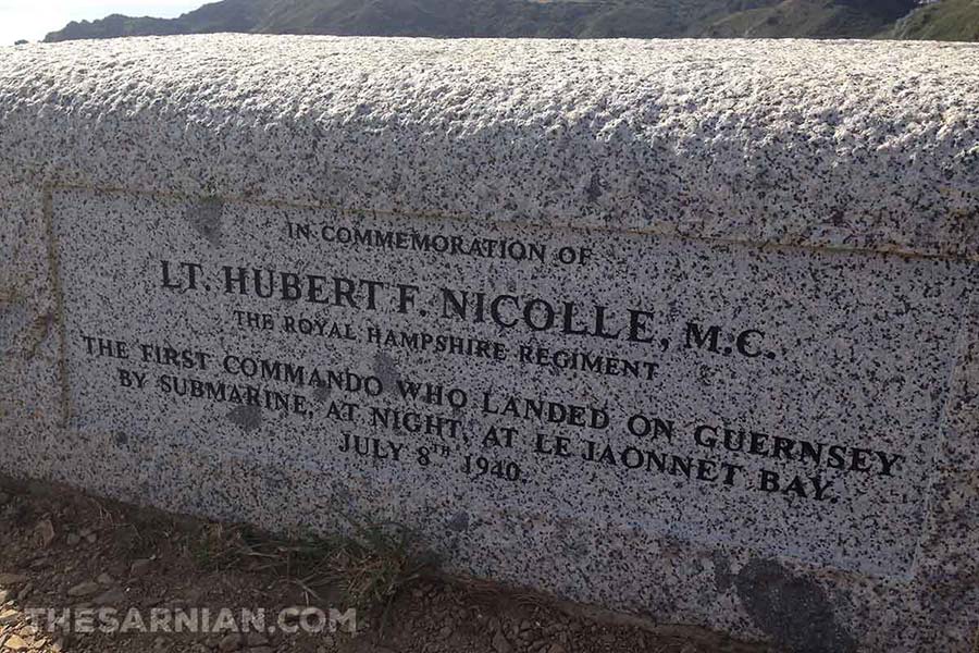
Jaonnet Bay was the site of a second world war raid on Guernsey by a British commando. Taking place on the night of 8 July 1940, when the island was under German occupation, it was led by Hubert Nicolle, a Guernseyman himself, who spent three days on the island and was picked up again by the Royal Navy so he could return to the mainland and give his report.
He was transported to the waters around Guernsey by submarine, but made his final approach to the south coast by canoe. He then met up with friends and acquaintances on the island, gathering information from as many as he could, before being collected by the submarine under cover of darkness.
Nicolle returned to Guernsey on a second information gathering mission two months later, but when his escape transport failed to turn up he was forced to surrender and was taken prisoner.

A fictionalised version of a larger commando raid takes place in book 2, Blowfish, where it is being filmed by the BBC 25 years before events in the story itself take place. Local builder Frank Hollett is one of the many extras employed to act in the production.

A carved granite stone was unveiled on the cliffs at Icart Point on the 70th anniversary of the raid at a point where you can look along the south coast towards the landing point at Jaonnet Bay.