Ibbott, Richelle
Richelle Ibbott is George Dixon’s partner. They aren’t married. Her body is discovered on the beach in Marble Bay in the opening scenes of book 1, Dead in the Water. She was 62.
Born into a rich family, she gave away her fortune and sold her large house at the centre of the island so that she could move into a smaller, terraced property above Marble Bay and donate all of her money to her charity, Ormer Orphans. She, herself, had been orphaned at the age of 16 while away on French exchange.
Prior to giving away her fortune she had been responsible for up to 10% of the island’s annual tax revenues.
She was in her early sixties at the time of her death but got away with dressing slightly younger. She was also a drinker and smoker. She was also friends with BBC Radio Guernsey producer Rosalynd Holdbrook.
On the day of her death, The Sarnian published the following potted summary of her life, not all of which was entirely accurate:
Orphaned at the age of sixteen, the slaughtered heiress gave up a sizeable fortune in her late forties — along with the family’s ancestral home close to Saumerez Park — and used the proceeds to fund Ormer Orphans, the charity for bereaved children she set up in memory of her slain parents.
She had lived since then in a modest Napoleonic terrace close to the bay where her decaying remains were discovered. She invited Dixon to move in shortly after his arrival on the island. Vendor details obtained as a result of diligent inquiries by Sarnian reporters revealed the house to be a single-bedroomed property. She and Dixon were unmarried at the time of her death
Icart Point
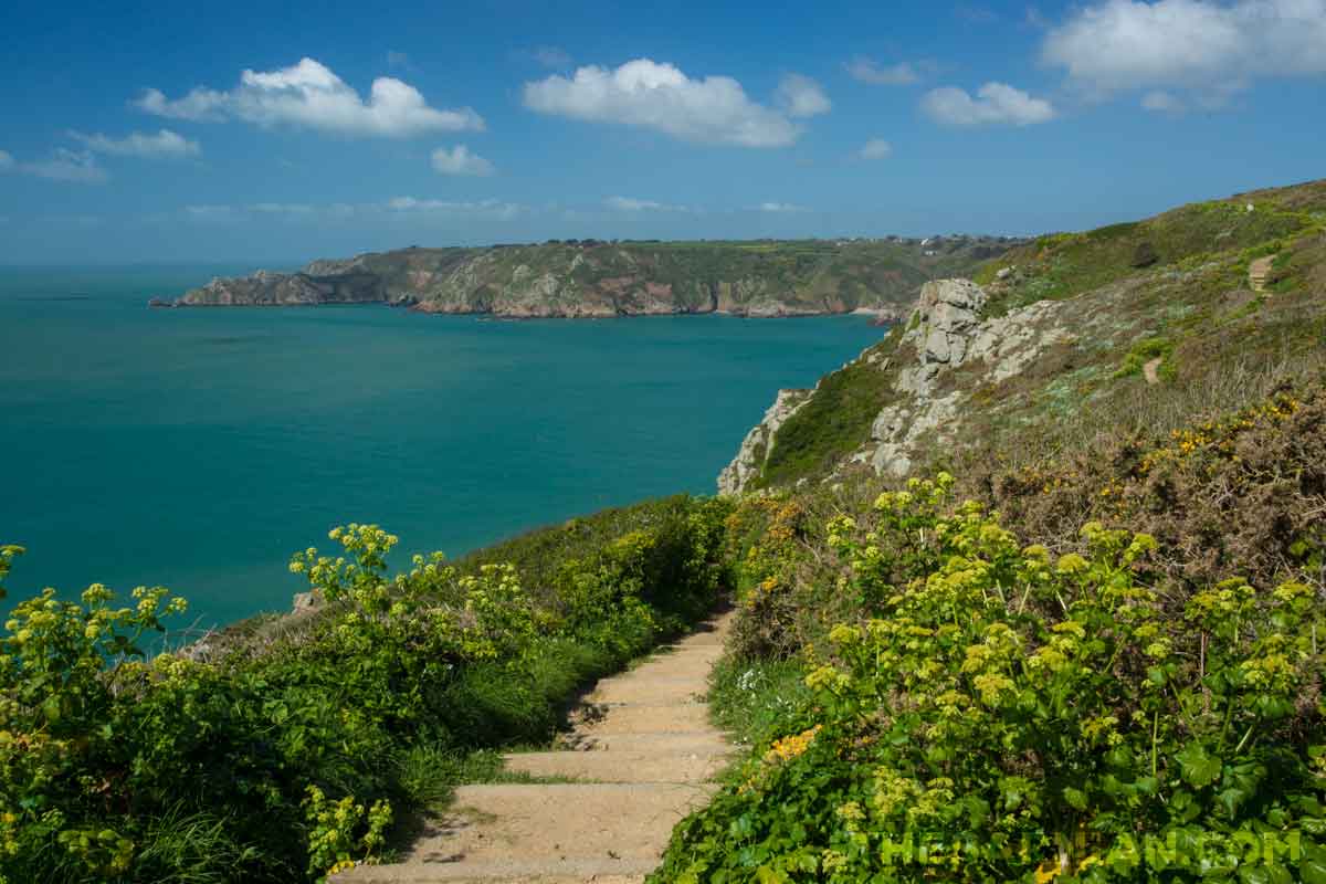
Icart Point is an impressive headland on the south coast of the island. It sits on the coastal path and is therefore a very popular passing point for walkers. Several benches there give unbeatable views along the south coast to both the east and the west (see above) depending on which side of the headland you sit on.
Icart Point is well known for its tea room, which sits in a secluded garden.

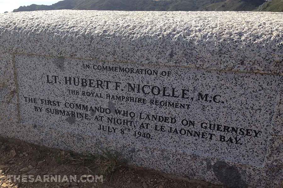
Heading west along the south coast from Icart Point would take you towards Jaonnet Bay, where a team of British Commandos staged a raid on the island during the Second World War, when it was occupied along with Jersey, Alderney and Sark by the German forces. This event is commemorated by a carved granite block at the back of the car park at the Point (above).

Continuing east from Icart Point will bring you down to Saints Harbour and from there to Saints Bay, at which point the route along the coast involves another climb to higher ground.

St Sampson
The northern town and port of St Sampson is known locally as the Bridge. Guernsey by GWS Robinson (published by David & Charles, Newton Abbott, 1977) describes how it was given this name as follows:
The only other harbour is St Sampson’s. It occupies what was once the eastern end of the Braye du Valle, a narrow salt-water channel which runs from St Sampson’s church to the Grand’ Havre, and at one time divided from he mainland of Guernsey an island measuring about 2 miles by 1 1/2 miles known as the Clos du Valle. The Braye was reclaimed during the Napoleonic wars, and the Clos now forms simply the northernmost section of Guernsey.
The road at the back of the harbour is still called The Bridge. The land was drained at the start of the 1800s. Work to reclaim it began in 1839 and continued until the end of the century.
Although not as large as the harbour at St Peter Port, St Sampson can accommodate sizeable vessels and was once a centre of shipbuilding on the island — particularly the building of ships used in exporting stone from the island’s quarry.
At first glance, St Sampson appears fairly industrial, primarily on account of the power station situated there, but it’s not far from Vale Castle and has good views of Herm on clear days. St Sampson parish is home to a school, sports ground, BBC Guernsey and the island’s prison.
St Sampson is also the name of the parish in which the town of St Sampson resides. This parish is split into two with the larger part sitting on the east coast and a smaller, entirely detached offshoot on the west. They are separated by the Vale parish.